First World War · Second World War

The ridges of remembrance

South and west of Lens, two hills saw some of the deadliest fighting on the Western Front: Vimy Ridge and the Lorette spur. Today, memorials and cemeteries of many nations stand just a few kilometres apart.

Givenchy-en-Gohelle · Vimy · 10 km from Lens UNESCO 2023

The Canadian National Vimy Memorial

At dawn on Easter Monday, 9 April 1917, the four divisions of the Canadian Corps attacked Vimy Ridge together, the first time they had fought side by side. Within four days they had taken high ground that French and British offensives had failed to hold. The cost was heavy: around 3,600 dead and more than 7,000 wounded. In Canada, the battle soon became a symbol of the birth of the nation.

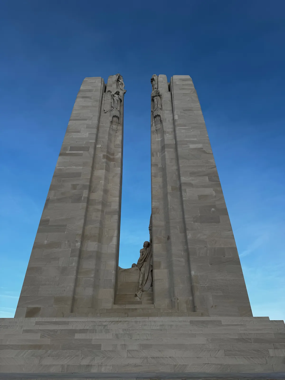
At the top of the ridge, the two white pylons by sculptor Walter Seymour Allward rise 30 metres high. The memorial took eleven years to build and some 6,000 tonnes of limestone from the Adriatic. King Edward VIII unveiled it on 26 July 1936. It carries twenty sculpted figures, and its walls bear the names of 11,285 Canadian soldiers killed in France who have no known grave. After restoration, it was rededicated on 9 April 2007, the 90th anniversary of the battle.

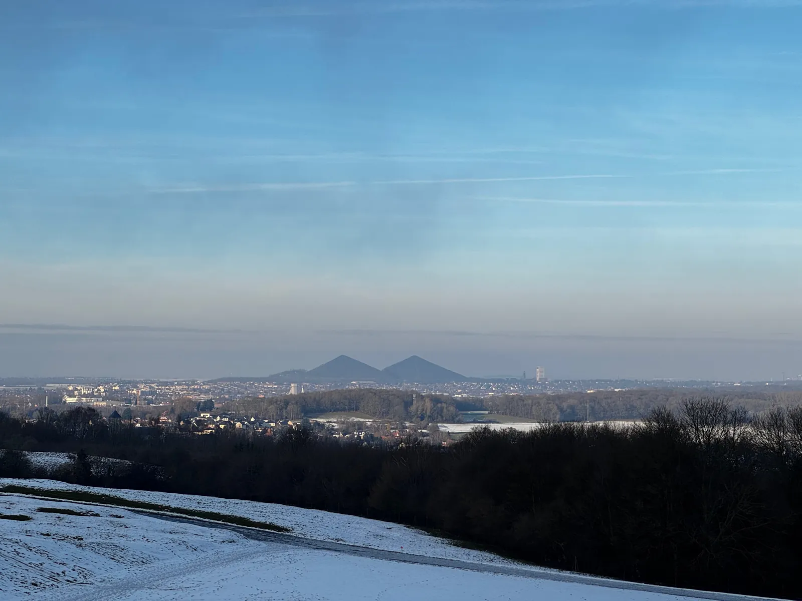
Facing the plain stands Canada Bereft, also known as Mother Canada: a veiled woman carved from a single block of stone. She looks east, towards the Douai plain. On a clear day the ridge also gives a view north over the coalfield and the twin slag heaps of Loos-en-Gohelle.
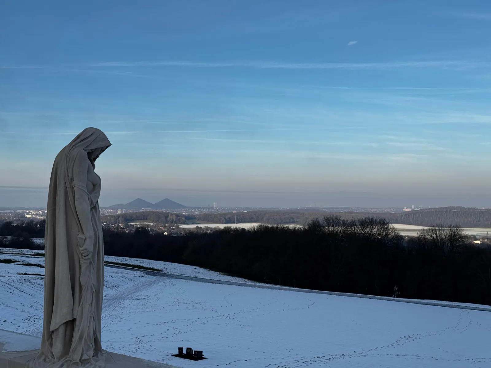
The Canada Bereft statue at the Vimy memorial, in the snow, looking out over the Lens plain and the twin slag heaps
“Canada Bereft” gazes over the plain. On the horizon, the twin slag heaps of pit 11/19. January 2025.

The park: trenches, craters and tunnels
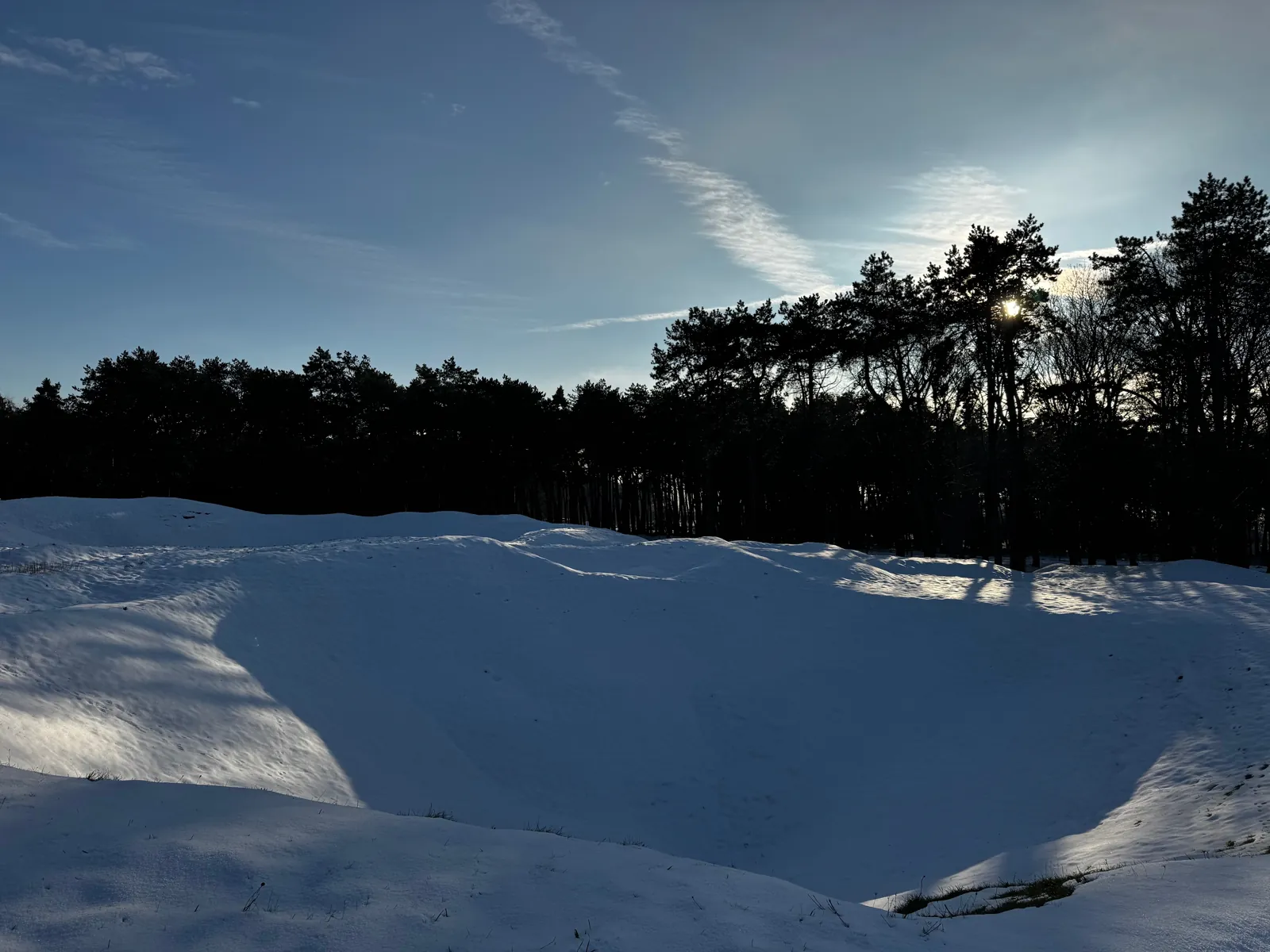
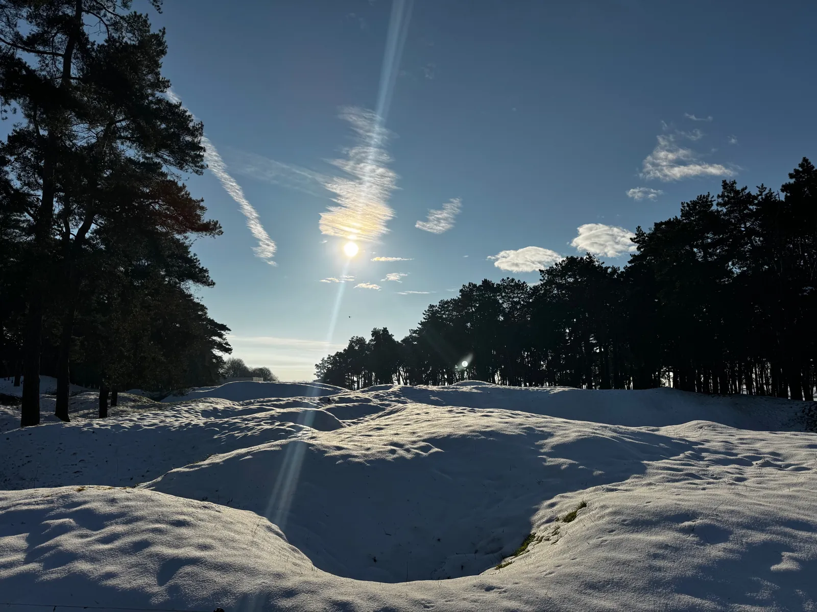
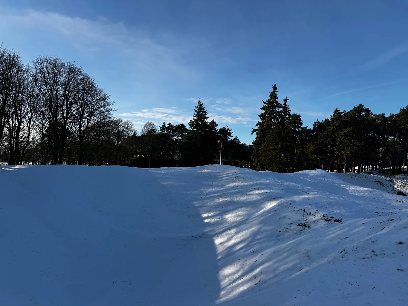
Snow-covered shell and mine craters in the Vimy park
The ground in the park is still churned up by shells and mines. January 2025.

France granted Canada the use of a 107-hectare park around the memorial in perpetuity. The land was never levelled: mine and shell craters still form a sea of hummocks, now covered in grass and pines planted after the war. Sheep graze the areas that remain dangerous and are closed to the public.

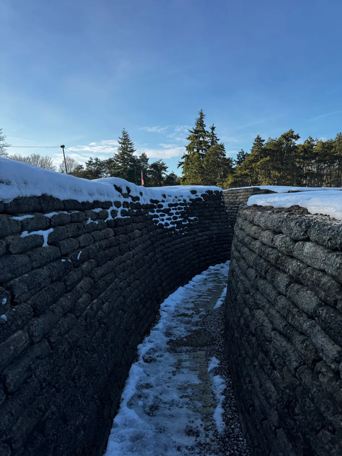
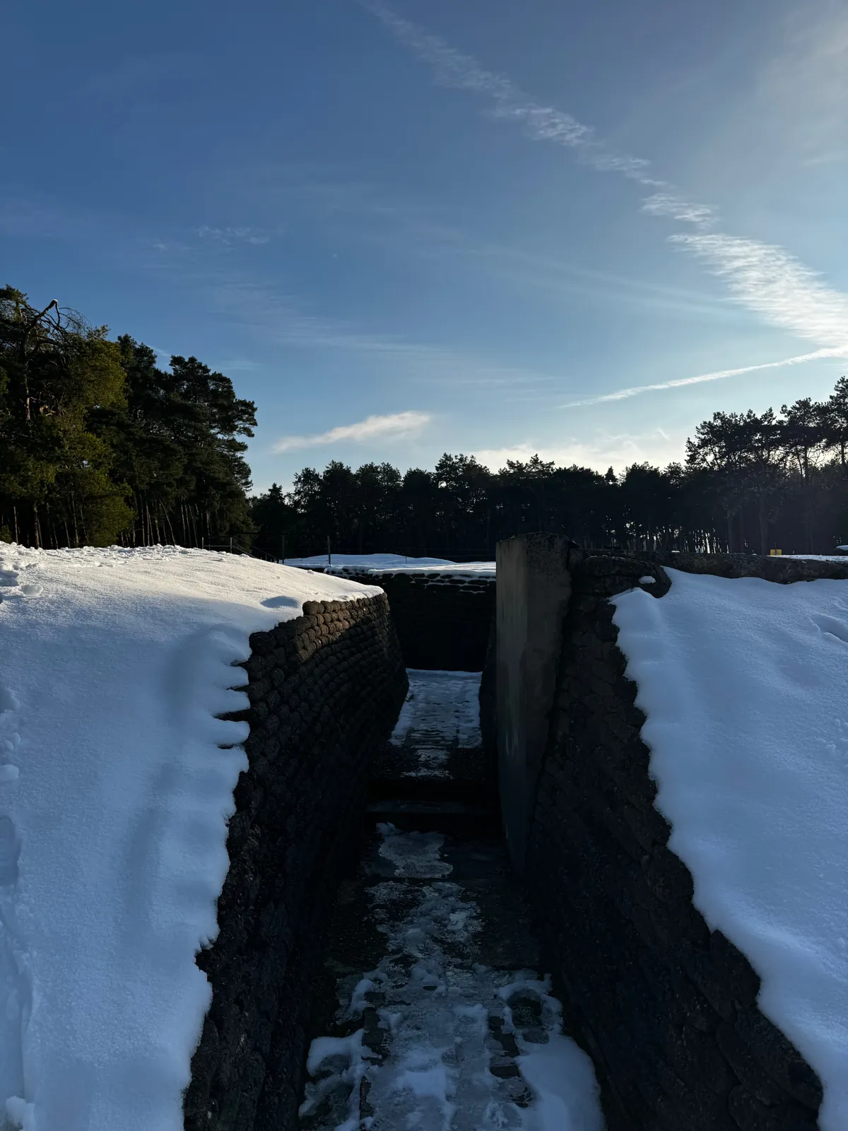
Near the entrance you can walk through trenches rebuilt with concrete sandbags, where the Canadian and German lines are only a few dozen metres apart. Underground, the Grange Subway sheltered troops before the assault; part of it can be visited with a guide.

The Visitor Education Centre, opened in 2017, tells the story of the battle and of Canada's part in the war. Canadian student guides lead free tours of the tunnels and trenches, in English and French.
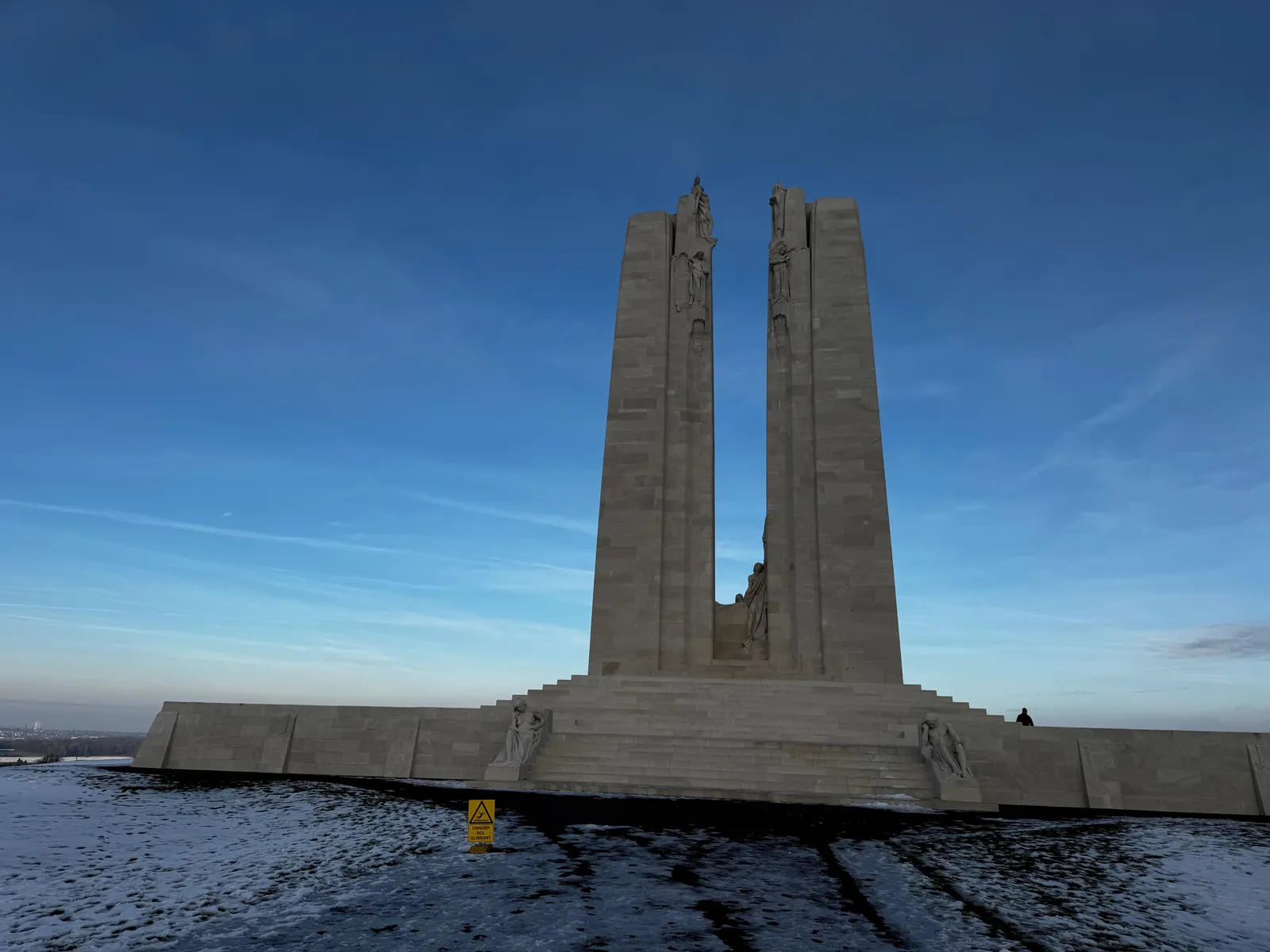
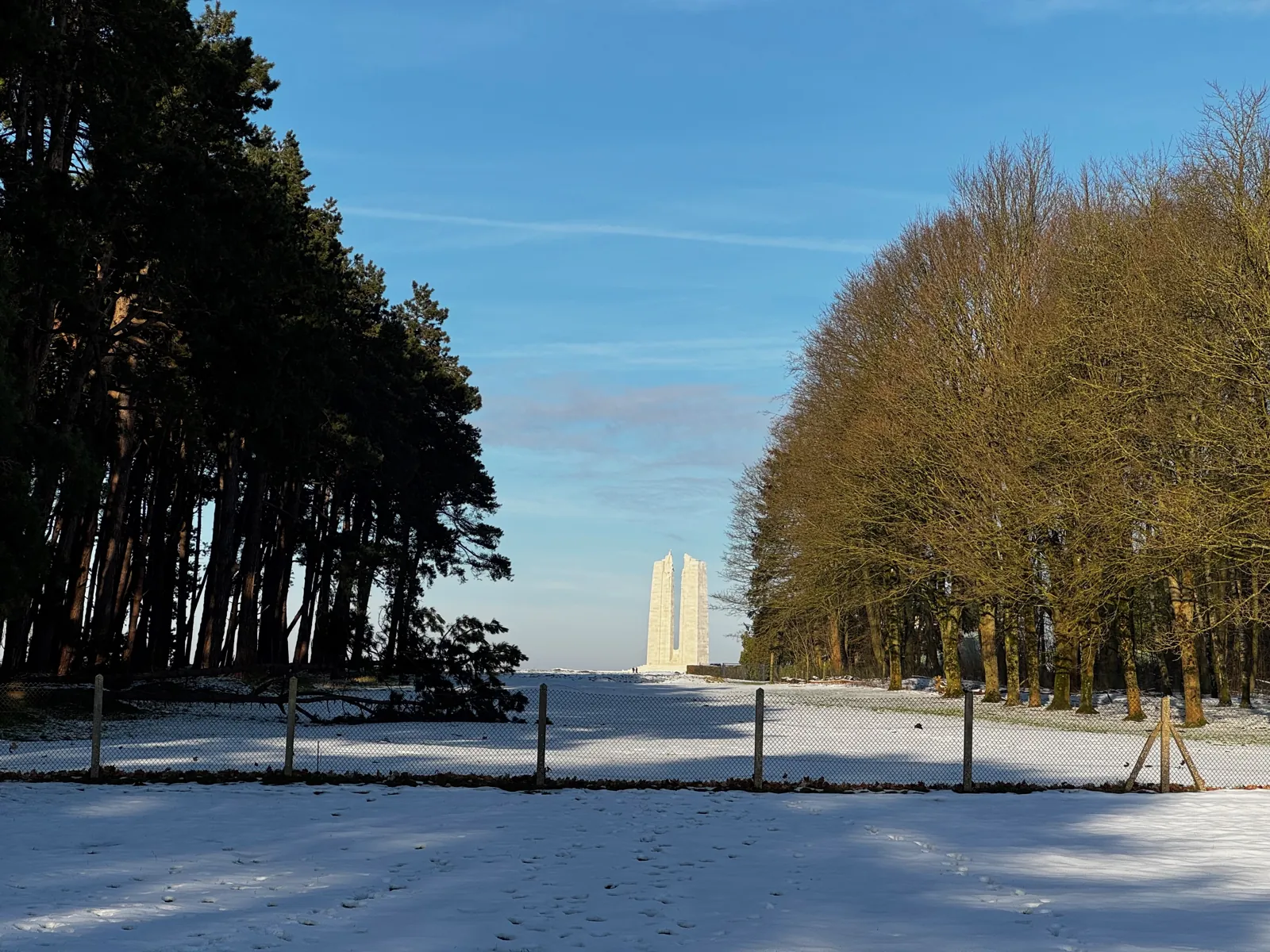
Practical tips. The park, the memorial and the visitor centre are free. Guided tours run without booking, subject to availability. The centre closes for a few weeks in winter and opening times vary with the season: check the Veterans Affairs Canada website before you go. A ceremony marks the anniversary of the battle every 9 April.

Vimy photos: January 2025.
Ablain-Saint-Nazaire · 12 km from Lens

Notre-Dame-de-Lorette and the Ring of Remembrance

UNESCO 2023Free access

The French national necropolis

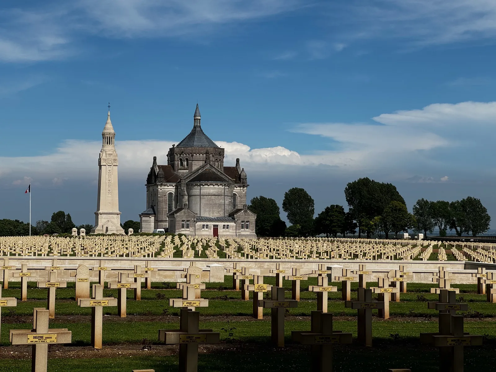
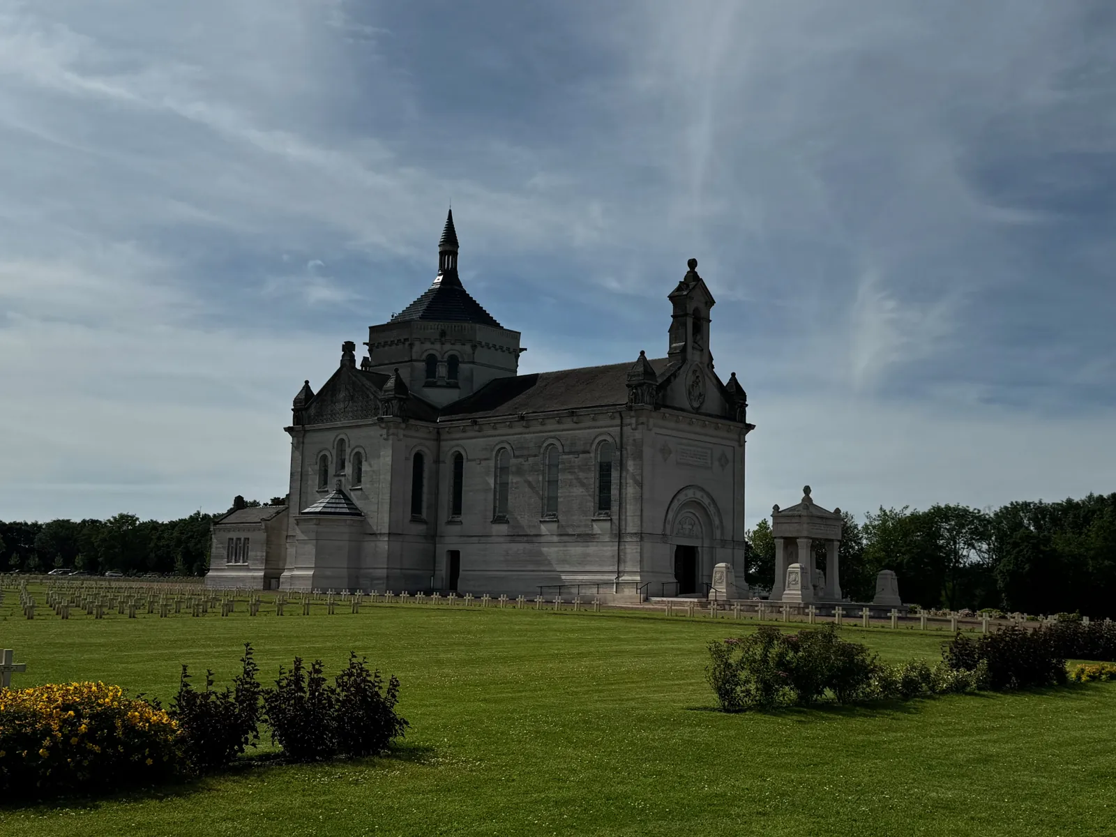
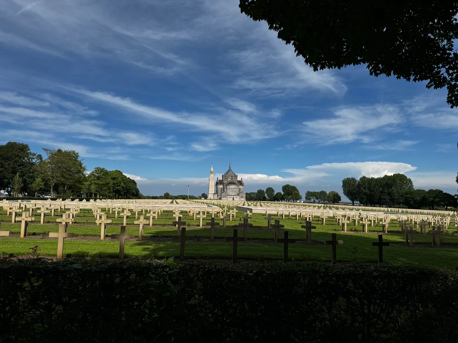
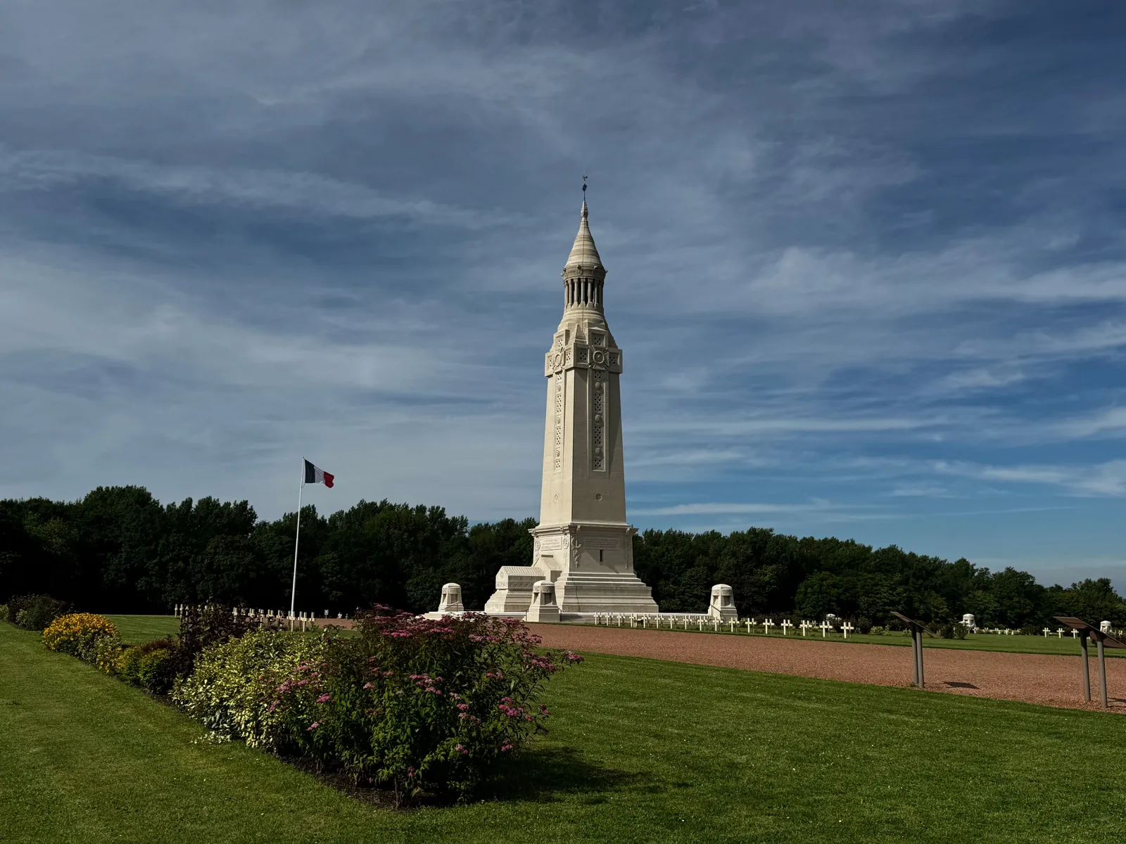
From October 1914 to autumn 1915, French and German troops fought metre by metre for this spur overlooking the Lens plain. The hill is now home to the largest French military cemetery: around 40,000 soldiers, 20,000 of them in individual graves and more than 20,000 unknown soldiers gathered in ossuaries.

Two buildings by the Lille architect Louis-Marie Cordonnier rise above the rows of crosses: a neo-Byzantine basilica and a 52-metre lantern tower, whose beacon sweeps the plain at night. The ossuary holds the remains of unknown soldiers from each conflict.

Free access Inaugurated on 11 November 2014

The Ring of Remembrance

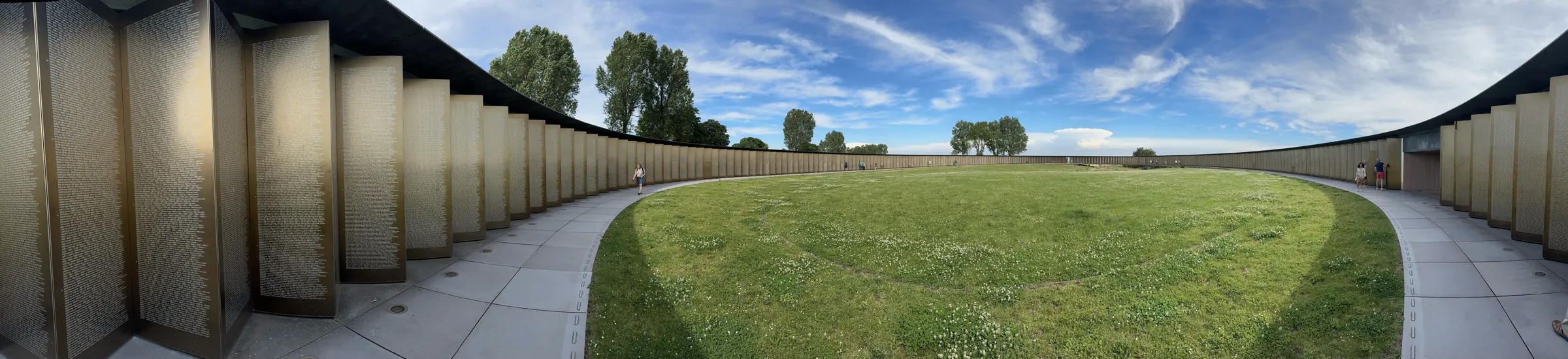
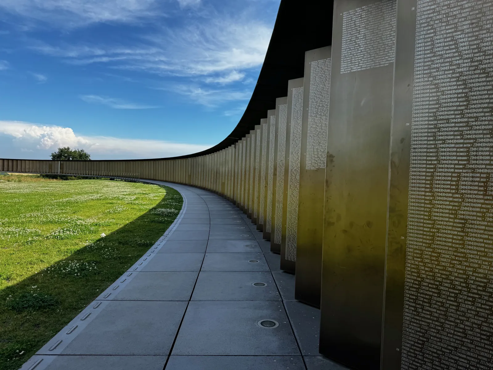
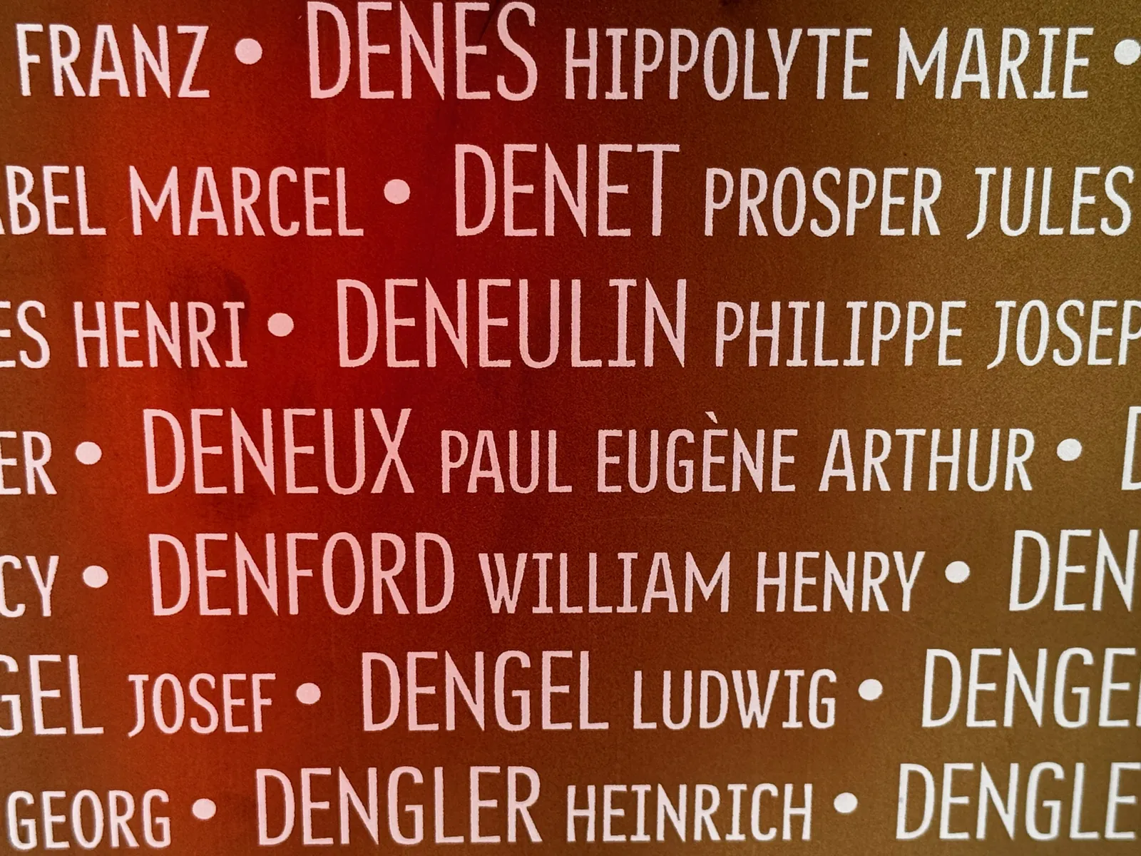
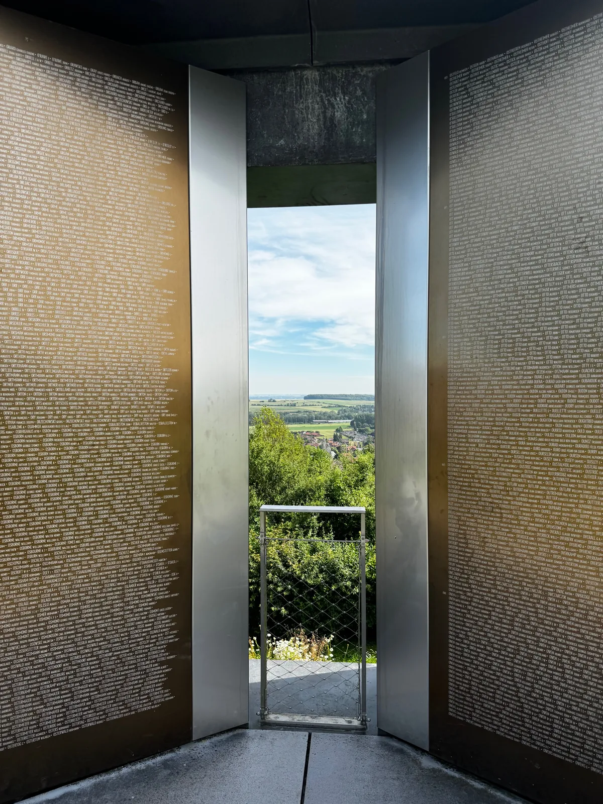
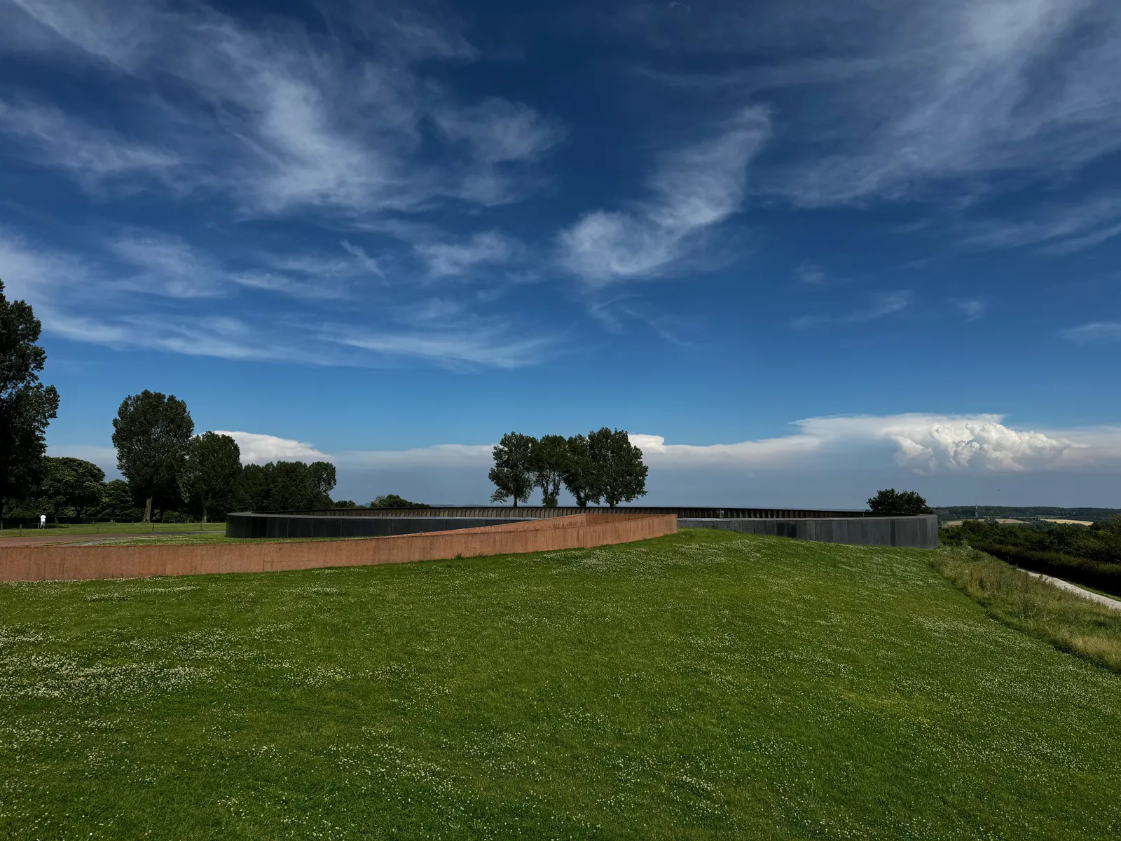
Right next to the necropolis, a large ring of dark concrete is cantilevered over the edge of the hill. Inside, 500 gilded metal panels bear 579,606 names: those of the soldiers who died in the Nord and Pas-de-Calais between 1914 and 1918.

Architect Philippe Prost's idea is simple and powerful: the names are listed in alphabetical order, with no distinction of nationality, rank or religion. A German, a Briton and a Frenchman who fell on the same ridge can thus end up side by side. The last panel has been left blank.

Panoramic view inside the Ring of Remembrance: the central lawn and the panels of names
Inside the Ring: panels of names all around, lawn in the centre. June 2024.

Lorette and Ring photos: June 2024.

The private museums at Lorette. The “Musée vivant 14-18”, at the foot of the basilica with its reconstructed trench, closed on 31 December 2025 and its collection was put up for sale. Its second site, the La Targette museum in Neuville-Saint-Vaast, is affected by the same closure. Phone before you go. The History Centre in Souchez remains the best place to understand the fighting.
Souchez · at the foot of Lorette

The Lorette 14-18 Memorial History Centre

A building of black concrete cubes designed by Pierre-Louis Faloci, opened in June 2015 at the foot of the hill. It was first known as “Lens'14-18”. Today it is part of the Mémorial'14-18, which also includes the necropolis and the Ring.

The centre does not display objects. Instead it shows more than 300 large-format photographs, archive films and animated maps. The exhibition goes beyond the trenches: it also covers the occupation of the mining towns, the flight of civilians and the rebuilding. It is the best place to start before heading up to Lorette or Vimy.

Free Closed on Mondays and Tuesdays, and throughout January. Opening times at memorial1418.com.

Why so many nations here?
From 1914 to 1918, the front line cut through Artois from north to south. Lens, Liévin and the pits stayed on the German side; Arras and Béthune on the Allied side. The Lorette and Vimy ridges, held by the Germans, were only retaken in 1915 and 1917. French soldiers (including the Moroccan Division), British, Canadian, New Zealand, Australian and Indian troops, Czech and Polish volunteers of the Foreign Legion, and Germans followed one another across a few square kilometres. Many left a cemetery or a memorial behind.
Neuville-Saint-Vaast · Souchez

The war cemeteries

Between Lorette and Vimy, the Béthune–Arras road runs past a string of cemeteries, each with its own national architecture.

UNESCO 2023 Neuville-Saint-Vaast

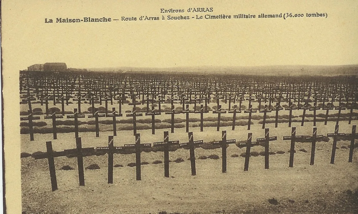
The German military cemetery of Neuville-Saint-Vaast (Maison-Blanche)

The largest German First World War cemetery in France: nearly 45,000 soldiers, more than 8,000 of them in a mass grave. Black crosses, four names to a cross, over almost 8 hectares.

UNESCO 2023 Neuville-Saint-Vaast

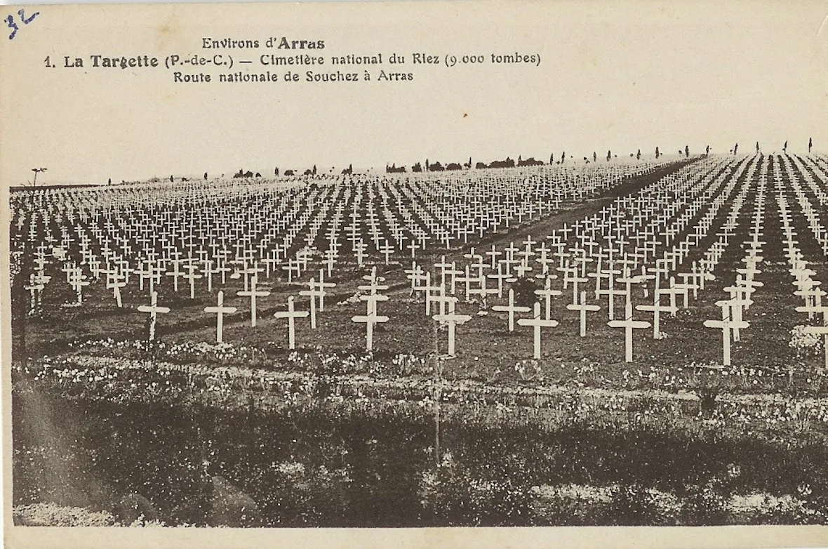
La Targette French national cemetery

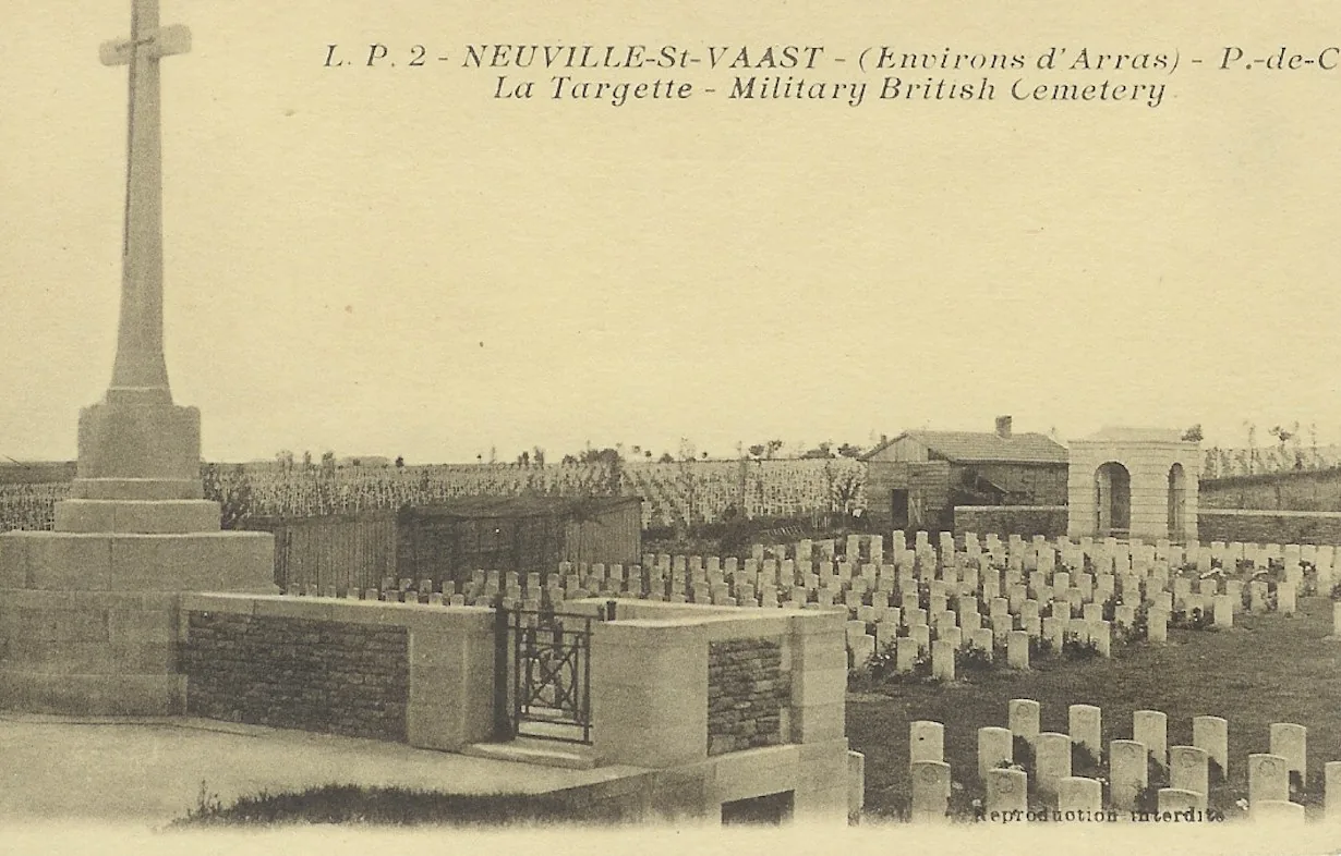
More than 12,000 graves from both world wars, mostly French soldiers killed in Artois in 1915, but also Belgians and Poles from 1940. La Targette British Cemetery lies right next to it.

UNESCO 2023 Neuville-Saint-Vaast

The Czechoslovak military cemetery

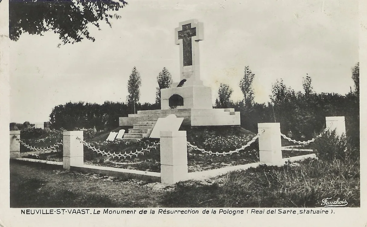
206 graves: 70 soldiers from the First World War, including Czech volunteers of the Foreign Legion killed attacking the ridge in May 1915, and 136 Czechoslovak soldiers from 1939-1945. It is the only Czechoslovak national cemetery on the Western Front. Opposite stands a monument to the Polish volunteers by Maxime Real del Sarte.

Souchez · Commonwealth

Cabaret-Rouge British Cemetery

More than 7,600 burials, over half of them unidentified soldiers. In May 2000 the Unknown Canadian Soldier was exhumed here; he now lies in front of the National War Memorial in Ottawa.

These sites are covered in more detail on the Neuville-Saint-Vaast heritage website ↗ (in French), which also tells the story of the village, razed in 1915.

Loos-en-Gohelle · on the edge of Lens

Loos: the Loos Memorial and Hill 70

UNESCO 2023 Battle of Loos, 1915

Dud Corner Cemetery and the Loos Memorial

On 25 September 1915 the British Army launched the Battle of Loos, using gas for the first time. Dud Corner Cemetery stands on the site of a German redoubt captured that day. Its name is said to come from the many unexploded shells, or duds, found there.

The walls around it form the Loos Memorial, designed by Sir Herbert Baker. Unveiled in 1930, it bears the names of more than 20,000 Commonwealth soldiers missing in the sector.

Battle of Hill 70, August 1917

Hill 70 Memorial Park

Four months after Vimy, from 15 to 25 August 1917, the Canadian Corps took Hill 70, high ground overlooking Lens. The battle long stood in Vimy's shadow. Since 2017 a memorial has honoured it: a stone obelisk, an amphitheatre, an interpretive pavilion and six walkways dedicated to soldiers awarded the Victoria Cross.

hill70.ca ↗

Arras · 20 km from Lens

Wellington Quarry

Beneath Arras lies a maze of chalk quarries dug since the Middle Ages. In the winter of 1916-1917, some 500 New Zealand tunnellers, many of them Māori, linked them together. They named the galleries after their home towns: Wellington, Auckland, Nelson…

On the night before 9 April 1917, the very day of the Vimy assault, 24,000 Commonwealth soldiers waited twenty metres underground. At dawn they emerged right at the foot of the German lines. Today a lift takes you down for a moving guided tour among the graffiti the soldiers left behind.

Paid entry Guided tours every day, except for about three weeks in January. Booking recommended at carrierewellington.com.

20 mbeneath the streets of Arras
24,000soldiers hidden before the attack
9 April 1917the same day as Vimy
The town at war

Lens, a martyred town

Lens was occupied by the German army in October 1914 and not liberated until October 1918. For four years the town lay just behind the front line. Its inhabitants were evacuated, and the retreating occupiers flooded and blew up the pits. By the Armistice almost nothing was left: more than 90% of the town was destroyed.

That clean slate explains how Lens looks today. The town, the mining company and private owners rebuilt everything in the 1920s, hence the wealth of Art Deco façades and the station shaped like a steam locomotive (see Mining heritage).

On the war memorial square, the Town is represented by a female figure. Around her stand a miner, a French infantryman (poilu) and a mother fleeing with her child: occupation and exodus carry as much weight here as the fighting.

Second World War · Arras

The Wall of the Executed

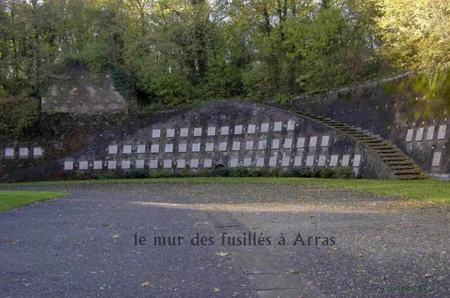
In the moats of the Arras citadel, the German authorities shot 218 Resistance members between August 1941 and July 1944. The youngest was sixteen and a half, the oldest sixty-nine. 130 of them were miners. The coalfield paid dearly for its resistance, which began with the great patriotic strike of May-June 1941, when more than 100,000 miners downed tools in the middle of the occupation.

The memorial is understated: a replica of the execution post and 218 name plaques lined up along the wall. It is freely accessible, within the citadel grounds.

The Wall of the Executed in the Arras citadel, with its name plaques
The Wall of the Executed, Arras citadel. Photo: René Bellanger
Suggestion

A day on the ridges

All these sites fit into a single day, with about sixty kilometres of driving.

  1. Morning: the Vimy memorial. Arrive early for the guided tunnel tour, then walk up to the monument.
  2. Cabaret-Rouge, on the road to Souchez.
  3. The History Centre in Souchez, when it opens, for the background.
  4. Notre-Dame-de-Lorette and the Ring of Remembrance. Picnic with a view over the plain.
  5. Neuville-Saint-Vaast: the German, French and Czechoslovak cemeteries.
  6. End the day in Arras: Wellington Quarry, then the Wall of the Executed at the citadel.